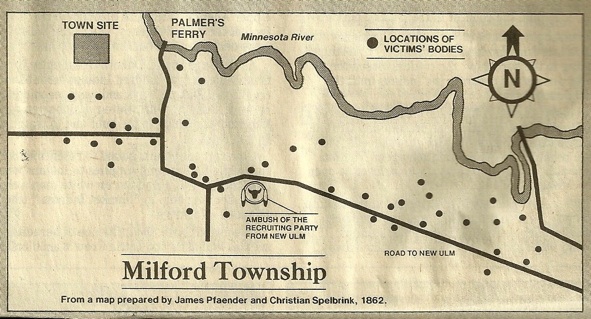
Maps of Dakota Uprising Sites, Monuments & Homesteads


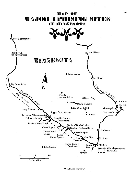
Map by Curt Dahlin, which appears on page 15 of his book "The Dakota Uprising: A Pictorial History.”

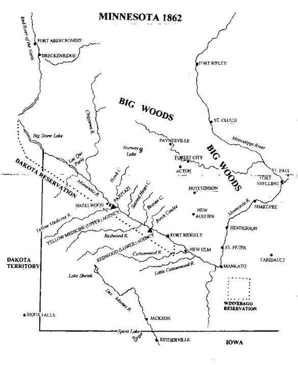
Map by Curt Dahlin, which appears on page 6 of his book, “Minnesota State Monuments to the Dakota Uprising.”
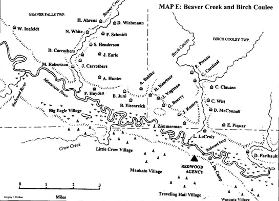
This map is one of 19 original maps from Gregory Michno's "Dakota Dawn.” It shows the cabins, creeks, the Redwood ferry and the Indian villages near Beaver Creek and Birch Coulee Townships. Descendants of these families have been located: P. Pereau, C. Cardinal, C. Clausen, C. Witt, D. McConnell, E. Piquar, L. LaCroix, J. Kumro, G. Buerry, J. Vogtman, A. Bahlke and B. Eisenreich. If you are related to any of the settlers shown on the map, please email me about your family. For more about Michno's book, see the link, Books Relating to the 1862 Dakota War.
Map courtesy of Gregory Michno, author of "Dakota Dawn"
To return to home page, click here: livepage.apple.com
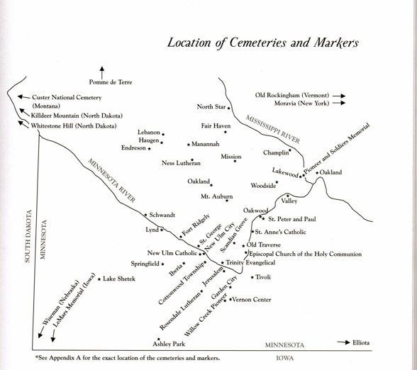
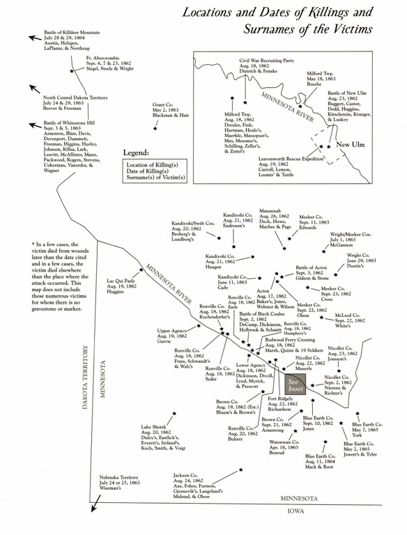
Credits for two above maps: Curtis Dahlin, from his book, “Dakota Uprising Victims Gravestones and Stories,” pp. 8-9.
Maps below from the St. Paul Pioneer Press Dispatch of August 16, 1987 on the 125th anniversary.
